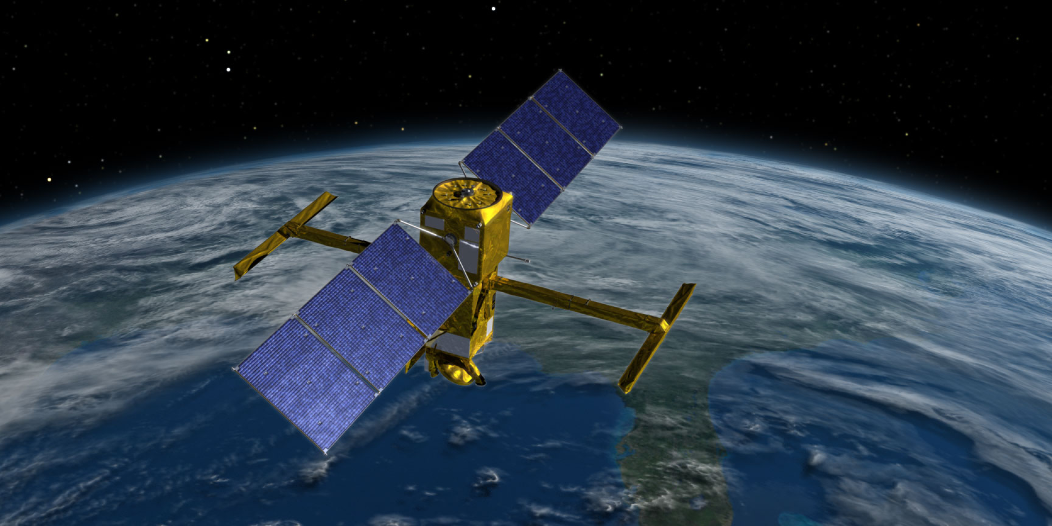
Led by the French space agency Centre National d’Études Spatiales (https://fscience-old.originis.fr/wp-content/uploads/2023/06/GLOC_Oslo_Norway_S2_27juillet2022_web-2-1.jpg) and NASA, SWOT will measure the height of water on over 90% of Earth’s surface, providing a high-resolution survey of our planet’s water for the first time. The satellite’s measurements of freshwater bodies and ocean waters will offer insights into the global ocean cycle and how it is closely intertwined with climate change.
“Our ability to measure freshwater resources on a global scale through satellite data is of prime importance as we seek to adjust to a changing climate,” said https://fscience-old.originis.fr/wp-content/uploads/2023/06/GLOC_Oslo_Norway_S2_27juillet2022_web-2-1.jpg Chairman & CEO Philippe Baptiste. “In this respect, the first views from SWOT give us a clearer picture than ever before. These data will prove highly valuable for the international scientific community in the fields of hydrology, oceanography and coastal studies.”
“SWOT’s advanced imagery will empower researchers and advance the way we manage fresh water and the effects of sea level rise across the globe,” said NASA Administrator Bill Nelson. “Water is one of our planet’s most important resources – and it’s proven to be vulnerable to the impacts of climate change. SWOT will provide critical information that communities can use to prepare for the impacts of a warming climate.”
Launched on 16 December 2022 from Vandenberg Space Force Base, California, SWOT is undergoing a six-month period called commissioning, calibration and validation. This is when engineers on the mission check out the performance of the satellite’s systems and science instruments before the start of science operations planned in July.
The information in the images was collected by SWOT’s Ka-band Radar Interferometer (KaRIn) instrument, the scientific heart of the satellite. It has antennas at each end of a 10-metre boom, enabling the instrument to look off to the sides of the satellite to measure the height of water with never-before-seen clarity.
Between January and March, SWOT measured sea-surface height in a part of the Gulf Stream off the coasts of America. It also acquired highly detailed views of surface water in the region around Toulouse, France. These post-processed images generated from the satellite’s measurements give a glimpse of SWOT’s operational capabilities.
The radar image produced shows a large number of freshwater bodies, including the River Garonne, 200 metres across where it flows through the centre of Toulouse, and the Canal du Midi, 20 metres across at its widest point. Many lakes can also be seen, like La Ramée covering 13½ hectares. The imagery is already demonstrating the satellite’s ability to detect water bodies, which is even better than expected and will prove vital to deliver data with high science value.
KaRIn produced ocean topography data of the Gulf Stream mapped as two wide, coloured strips spanning a total swath of 120 kilometres. Red and orange areas in the image represent sea levels higher than the global average, while blue shades represent sea levels lower than the average. This imagery exhibits a significant improvement in resolution over other altimetry satellites already in orbit, revealing ocean dynamics and the amplitude of eddies for the first time over a period of several days, thanks to the daily revisits afforded by SWOT’s calibration orbit. The clarity of the data illustrates the dramatic evolution in the technology used to measure sea-surface height from space. The spatial resolution of the SWOT ocean measurements is 10 times greater than a composite of sea-surface height data over the same area from seven other satellites currently in operation: Sentinel-6 Michael Freilich, Jason-3, Sentinel-3A and 3B, Cryosat-2, AltiKa and Hai Yang 2B.
SWOT was jointly developed by NASA and https://fscience-old.originis.fr/wp-content/uploads/2023/06/GLOC_Oslo_Norway_S2_27juillet2022_web-2-1.jpg, with contributions from the Canadian Space Agency (CSA) and the UK Space Agency (UKSA). The Jet Propulsion Laboratory (JPL) leads the U.S. component of the project. For the flight system payload, NASA provided the Ka-band Radar Interferometer (KaRIn) instrument, a GPS science receiver, a laser retroreflector, a two-beam microwave radiometer and built the payload module delivered to https://fscience-old.originis.fr/wp-content/uploads/2023/06/GLOC_Oslo_Norway_S2_27juillet2022_web-2-1.jpg. https://fscience-old.originis.fr/wp-content/uploads/2023/06/GLOC_Oslo_Norway_S2_27juillet2022_web-2-1.jpg provided the Doppler Orbitography and Radiopositioning Integrated by Satellite (DORIS) system, the dual-frequency Poseidon altimeter (developed by Thales Alenia Space), the KaRIn radio-frequency subsystem (together with Thales Alenia Space and with support from UKSA) and the satellite platform, and developed the satellite’s ground control segment. https://fscience-old.originis.fr/wp-content/uploads/2023/06/GLOC_Oslo_Norway_S2_27juillet2022_web-2-1.jpg is also responsible for operations and for processing data received daily from the KaRIn instrument. CSA provided KaRIn’s high-power transmitter. NASA provided the launch vehicle.

