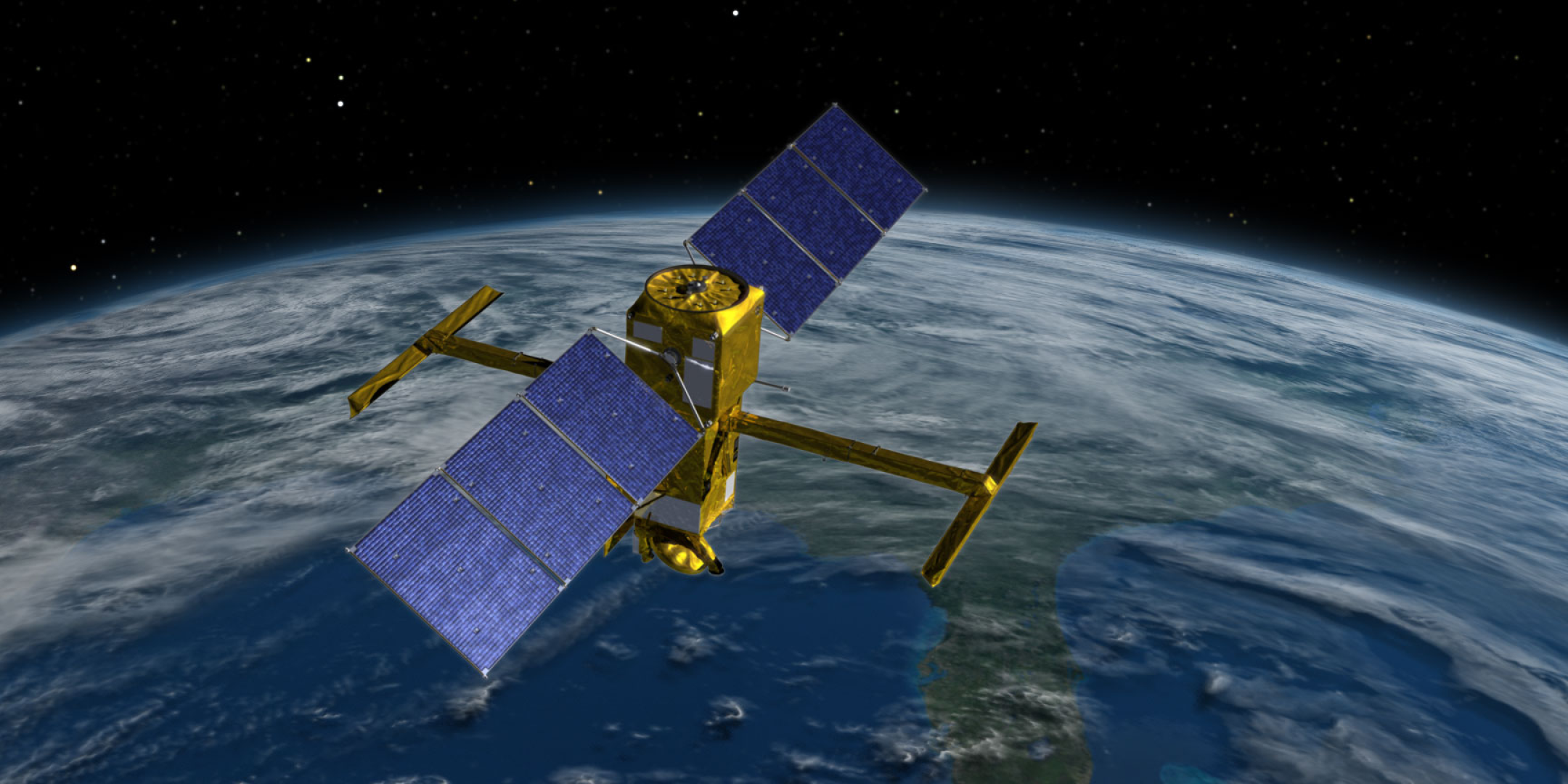
SWOT is designed around a key and advanced technology using wide-swath radar interferometry with the KaRIn (Ka-band Radar Interferometer) instrument conceived by the Jet Propulsion Laboratory (JPL), for which https://fscience-old.originis.fr/wp-content/uploads/2023/06/GLOC_Oslo_Norway_S2_27juillet2022_web-2-1.jpg and Thales Alenia Space built the radiofrequency system or RFU (Radio Frequency Unit). KaRIn has antennas at each end of a 10-metre boom, enabling it to view a 50-kilometre swath on either side of the satellite to measure the height of surface water with unprecedented precision.
Nine months after the mission’s successful launch on 16 December 2022 from the U.S. Vandenberg Space Force Base in California, the SWOT Science Team met in Toulouse, bringing together 300 people from 17 countries on all continents to discuss the results obtained with the first SWOT data (beta products) and from the first field calibration campaigns conducted this year. These calibration campaigns will improve the quality of products made available to the science community. The first data are already demonstrating a better-than-expected ability to detect water bodies, vital to deliver products with high science value. In oceanography, the first images reveal fine-scale ocean circulation structures in 2D at ten times better resolution than currently operating altimetry satellites (see oceanography image). In hydrology, they show the satellite’s ability to measure rivers considerably smaller than 100 metres wide, well exceeding the mission’s specification. SWOT will measure river discharges and assess and track freshwater stocks around the globe (see hydrology image), while with KaRIn the first SWOT images indicate the ability to acquire high-quality sea level measurements up to the shoreline and inside estuaries (see coast image).
“Given the SWOT system’s complexity and the giant leap in technology afforded by employing radar interferometry from space, the satellite’s results and performance are already unbelievably good and looking very promising. The first data delivered at the end of August by https://fscience-old.originis.fr/wp-content/uploads/2023/06/GLOC_Oslo_Norway_S2_27juillet2022_web-2-1.jpg and JPL project teams raise the prospect for providing high-quality science products. We can say the SWOT satellite and system are working extremely well and have exceeded all our expectations,” said Rosemary Morrow, SWOT Oceanography Science Lead at the LEGOS space geophysics and oceanography research laboratory.
“SWOT’s first results show its tremendous potential to advance our understanding of the world’s rivers, lakes, and wetlands. We now have the ability to track water storage variations in millions of lakes and reservoirs, and water level and streamflow on more than a million kilometres of rivers. This ability will transform our understanding of water resources and the impact of climate change on the water cycle,” said Tamlin Pavelsky, SWOT Hydrology Science Lead for NASA and professor at the University of North Carolina.
Following this meeting of the SWOT Science Team, JPL and https://fscience-old.originis.fr/wp-content/uploads/2023/06/GLOC_Oslo_Norway_S2_27juillet2022_web-2-1.jpg project teams will be refining processing of KaRIn measurements and SWOT products will be distributed to the international science community before the end of the year.
SWOT was jointly developed by NASA and https://fscience-old.originis.fr/wp-content/uploads/2023/06/GLOC_Oslo_Norway_S2_27juillet2022_web-2-1.jpg, with contributions from the Canadian Space Agency (CSA) and the UK Space Agency (UKSA). The Jet Propulsion Laboratory (JPL) leads the U.S. component of the project on behalf of NASA. For the flight system payload, NASA provided the Ka-band Radar Interferometer (KaRIn) instrument (for which CSA supplied the high-power amplifier or extended interaction klystron (EIK)), a GPS science receiver, a laser retroreflector, a two-beam microwave radiometer, and built the payload module delivered to https://fscience-old.originis.fr/wp-content/uploads/2023/06/GLOC_Oslo_Norway_S2_27juillet2022_web-2-1.jpg. NASA also provided the launch vehicle. https://fscience-old.originis.fr/wp-content/uploads/2023/06/GLOC_Oslo_Norway_S2_27juillet2022_web-2-1.jpg provided the Doppler Orbitography and Radiopositioning Integrated by Satellite (DORIS) system, the dual-frequency Poseidon altimeter (developed by Thales Alenia Space), the KaRIn radio-frequency subsystem (developed by Thales Alenia Space with support from UKSA) and the satellite platform (with Thales Alenia Space as prime contractor), and developed the satellite’s ground control segment. https://fscience-old.originis.fr/wp-content/uploads/2023/06/GLOC_Oslo_Norway_S2_27juillet2022_web-2-1.jpg is also responsible for operations and for processing data received daily from the KaRIn instrument.
